
For those of you not familiar, “The Salazar Survey” is an account by Clay Worst about attempts in 1949 to find the meaning of maps and photos brought to Arizona by Cristobal Peralta in 1924. Only the happenings in 1924 are discussed here. This story is in Dr. Glover’s book, “Treasure Tales of the Superstitions”, and many thanks from this author to Mr. Worst for writing it, and Dr. Glover for including it in his book. A pdf of the article with full credits(but the sketch that Dr. Glover includes is not here) can be found at the link:
In summary, Cristobal (72 yrs. old) was from Spain, but was born and raised in Mexico. He came to Tucson in 1924, and at the Alianza Hispano-American, contracted the services of Perfecto Salazar, a Spanish-speaking American and former resident of Florence, as an interpreter to help him find records in Pinal and Maricopa counties of rich mines in the Superstitions his family used to operate there. After days of research, Cristobal drove Salazar from Phoenix to the Superstition mountains to visit the area where the mines were located. They “pulled over, several miles” north of Apache Junction on Roosevelt Road (later to become the Apache Trail and Highway 88). Cristobal then shared a story that described members of the Peralta family undertaking a clandestine expedition in the winter of 1853-54 to mine for gold one more time and hide the mines (once again). They used surveying equipment to survey the mine location and the area, and they took small photographs of the mine site from varying distances (including one from high ground near the mine) with “El Sombrero” in the background of all of them. Cristobal then showed Salazar 3 small glass photos and a detailed map of the Superstitions area (and the location of the mine) that included 4 Peaks, the Salt River, and the area extending to the Gila River.
Later, Salazar said that he wrote down on a brown paper bag some of what he saw on the map, and later apologized that he did not remember more.
These are important excerpts from the Clay Worst account:
“The map, Peralta explained, was a survey of the mine site. The bearings and distances were referenced to the salient pinnacle, El Sombrero. In particular, a line ran northward from the pinnacle, accompanied by the numbers 4 and 62. There was also a transverse line running between three red hills and a two-room cave. A notation indicated that the pinnacle was 14 kilometers south of the Rio Salado. The meridian of reference for the survey was determined by an observation of Polaris, the north star, on the night of April 13th, 1854. It was important Peralta asserted, that the survey be done on the exact day of the year, so that the stars would occupy the same positions in the heavens as they did in the heavens as they did at the time of the original survey”.
“The mines were then carefully closed and concealed, lest they fall into the hands of the “Yanquis” who have taken this area without any benefit of right”.
“Salazar was also allowed to view, briefly, the three photographic glass plates. They were darkened by age, and it was difficult to ascertain much more than the outline of the skyline, with little foreground remaining. All three photographs were of the salient pinnacle, El Sombrero. The first photograph, Peralta stated, had been taken from the summit of the first high mountain in the direction of the mine from the camp on the Rio Salado. The spot was indicated on the map by a small square symbol, and lay near a meandering trail between the camp and the mine site. The second photograph was taken from the summit of the second high mountain in the direction of the mine. The pinnacle was not visible along the route between the sites from which the two photographs had been made. The third photograph was taken from high ground above the mine site.”
These inferences were drawn from the article:
• An accurate map in 1853, aligned with true north, could have been created by using a baseline that was derived from the sun or Polaris. But, it does not matter what date or time the north star is shot with a transit if an ephemeris or an alternate method Clay described is used to get a baseline for the survey.
• To find a specific location in no-man’s land, a scaled map with reference to north is all that is needed if landmarks are marked on the map and they can be seen. Apparently, that is what Salazar got to look at. But if you do not have a map, or do not want to continually drag it out, the bearings to 2 known landmarks from the unknown location are needed. Where imaginary lines created by those bearings intersect is the referenced location. It is apparent that Cristobal had both of these methods to choose from.
• It is apparent by reading the article that there was anti-American sentiment displayed by Salazar in 1924 considering comments about “Yanquis”, and the Mexican American war. After some research, it is unlikely the Alianza Hispano-American organization he was a member of in 1924 displayed the American flag in their lodges. Salazar surely did not want an American to find the mine.
• Salazar was picked because of his knowledge of the Superstitions area, his skill as an interpreter, and someone befitting a visiting dignitary. He appears to have been very intelligent.
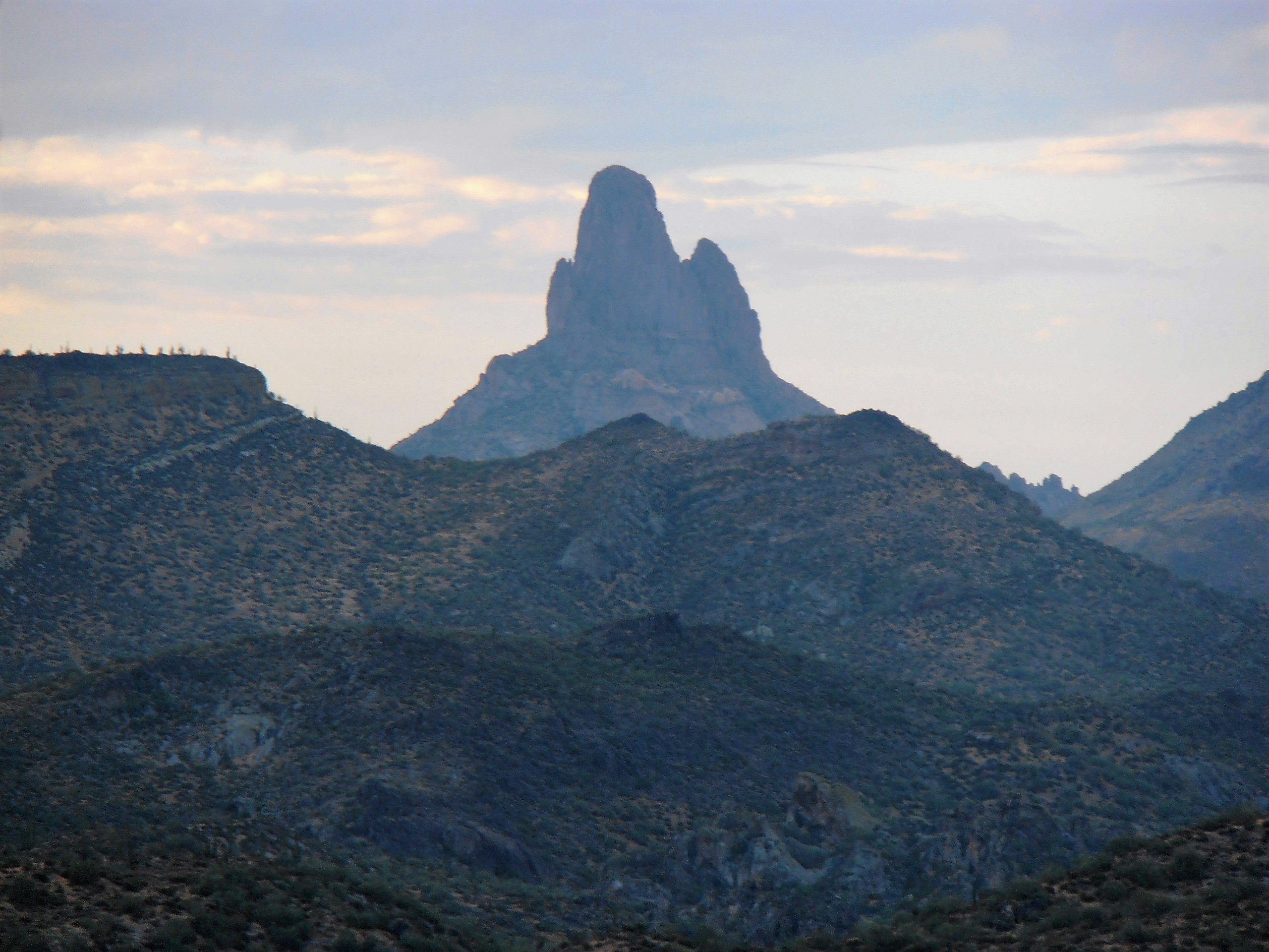
• The small photos had to have some value, or Cristobal would not have brought them. Weaver’s Needle looks like a sombrero only in a very narrow band extending to the northwest from the Needle. Salazar said El Sombrero was in the background of all of the photos. While driving north on Highway 88 from Apache Junction, the full El Sombrero can be seen for only one brief instant, and is not able to be seen again until reaching the Needle Overlook (and it looks like a sombrero there). It is proposed that the Needle Overlook is where Perfecto and Cristobal pulled off and stopped the car.
It was thought the numbers 4 and 62 are the numerical portions of quadrant bearings from the mine to known landmarks. Lewis and Clark used quadrant bearings, and they were common even 50 years ago.
So, if 4 and 62 are references to quadrant bearings, where would they radiate from, and where would they pointing to?
Following a hunch, if the partial quadrant bearings reference the most obvious large silica mound, dubbed “Cerro Negra” by the author, the full quadrant bearings would be:
S 62 E
N 4 E
These would be the bearings shot from Cerro Negra and are referencing El Sombrero (Weaver’s Needle) and the tiny hole through the mountain that can be seen along First Water road just as the sun comes up (photo below) for about 45 minutes. Note: This is the same tiny hole that is indicated on the “Trail Stone Map” of the Peralta Stone maps.

This is another view during the summer of the tiny hole at sunrise that can be seen all along First Water road.

It was presumed that these bearings were based on true magnetic north, because if someone was giving these bearings for in-house use, the bearing would be used with a compass without the complications of calculating declination (the angle between true north and magnetic north). Using Google Earth, it appeared the hunch may be true.
To validate the bearings from 1853 and take actual bearings, a Brunton “pocket transit” (photo below) was taken to Cerro Negra.

The Brunton was used with the declination set at 0 as shown above. El Sombrero was shot with the Brunton at:
S 65 E
The bearing taken with the Brunton to the “tiny hole” through the top of the mountain to the north of Cerro Negra and was:
N 2 E
These do not match the S 62 E and N 4 E exactly, but the change in declination has to be taken into account. NOAA data gives declination change between 1853 and 2017 at minus 3 degrees; in 1853 the declination was 13 degrees E, and for 2017, 10 degrees E. In the below diagram the bearings in 2017 and 1853 are shown with the declination change applied.

If the declination moved 3 degrees west between 1853 and 2017 as NOAA indicates, the bearings that Salazar partially described would EXACTLY match the bearings shot recently from the top of Cerro Negra if adusted for the declination change over time (rotated counterclockwise). The bearing to the hole through the mountain is off by only one degree. This is within the margin of error of the Brunton compass, and the overall results are astounding due to the highly magnetic rock of Cerro Negra.
As expected, the arcs swung between the landmarks in 1853 and 2017 are almost the same (off by one degree). This is damning evidence that the bearings from 1853 and 2017 reference the same landmarks. Note: It is important to note that this cannot be duplicated exactly using Google Earth because the high magnetism of Cerro Negra turns the compass a few degrees from magnetic north.
The odds of these bearings matching by coincidence on a location that was picked beforehand out of hundreds of square miles (Cerro Negra) are infinitesimally small. This was the first spot that was picked! These conclusions are drawn:
• Mr. Salazar seems to have developed a case of selective amnesia regarding what he saw on the map Cristobal showed him. Amnesia created by money, loyalty, sworn oath, or dislike of Americans because of the Mexican American War?
• It is highly likely that Cristobal Peralta walked to Cerro Negra and the mines. It is an easy 15 minute hike up a flat wash to Cerro Negra from where the end of the Needle Overlook sidewalk is today. Or, they drove up First Water Road, near the current overflow parking lot, and it was a 10 minute walk!
• This has been known to the writer for some time, and the compass bearings reinforce the issue: The Peralta mines are not in the wilderness area. They are not in exceedingly rough terrain. And, the orebodies are not primarily quartz veins.
These are re-creations of Cristobal Peralta’s photos that were taken in 1853:
Photo #1 . The tall ridge can be seen as described in the story, that El Sombero cannot be seen while walking between where photos #1 and #2 were taken. It can’t be seen (this is near Highway 88).

Photo #2. This is Cerro Negra on the S 65 E bearing. This is a silica mound with a breccia pipe, and this hill is detailed in the “Great Mine” page. There are no annotations needed for this photo.

Photo #3. This is El Sombrero at S 65 E taken from Cerro Negra. There is a clue that when looking from the Lost Dutchman Mine towards El Sombrero (Weavers Needle), it looks like you are looking through a gun sight. May the reader be the judge.
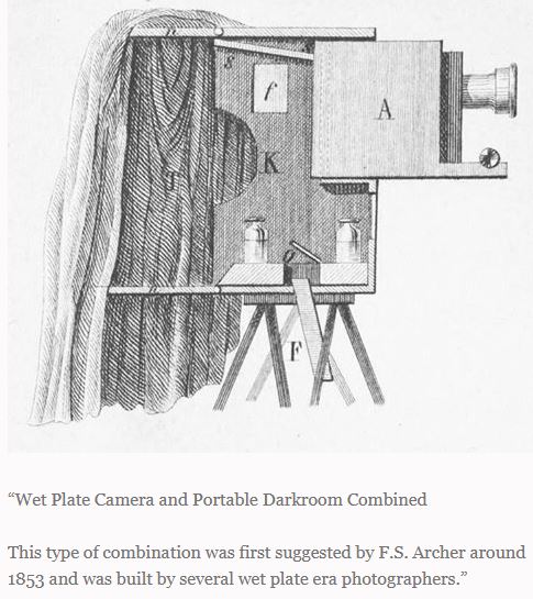
It is clear by reading the Salazar Survey story that Cristobal brought the negatives of the photos. The negatives from the wet plate process are on glass. The wet plate process (ambrotype) that was available at the time created negatives in the field that could be used to make multiple paper copies in the studio. Why Cristobal brought them is unknown (maybe he did not know any better?).
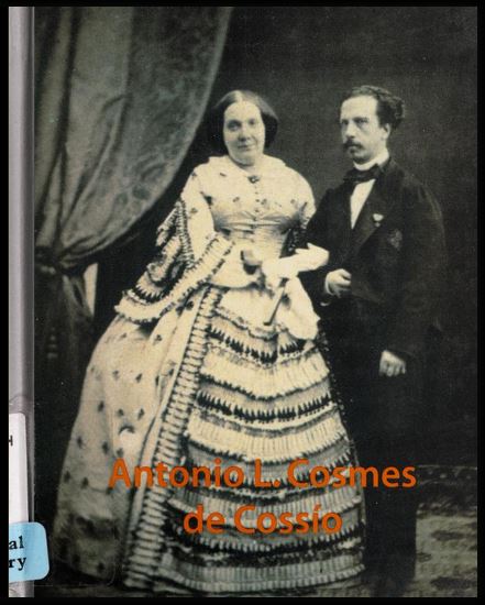
By research, there was one single person it is believed that would have been selected by the Peraltas that could have pulled off the photography at the Peralta Mines in 1853……… Antonio Cosmes. He had the potential political inclination, and the skills that probably no one else in Mexico had at that time. He was a pioneer in photojournalism as well.
Around 1850 there was an elite group of photographers based in the U.S. and a member of this group was from Mexico City and was Antonio L. Cosmes de Cossio (Antonio L. Cosmes). He traveled to the U.S. in 1849 to learn about the latest American photographic techniques, and bought the latest American camera “back” for his studio in Mexico City in 1851. Cosmes was a champion of the wet plate process (ambrotype), and when he moved to Spain, Cosmes taught the photographers there the process. He was so good that he even became the official photographer of Queen Isabella of Spain. His father was an officer in the Mexican revolution that overthrew Spain. In 1853 there was a great hatred for the U.S. in Mexico, and the entire southwestern U.S. was in chaos due the California gold rush (California had just been stolen from Mexico). He “left” Mexico City for a move to Spain in 1852.
The Antonio Cosmes collection is in the Colección Castellano in the National Library of Spain. The chronological period of the Colección Castellano runs from 1853 to 1880.
If anyone sees a photo in there of a bunch of guys standing around a mine shaft that is from “location unknown”, you may want to investigate it further.
Below is a combination wet plate camera and darkroom that was available to Cosmes at that time for taking to remote locations.
Below is a picture of Antonio Cosmes.
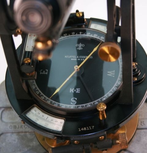
Below is a transit from the 1940’s that uses quadrant bearings. The author learned to survey with one of these, doing all calculations with a hand calculator.
It is believed that the Peralta mines were mostly underground in the later years of the District’s operation, and they were alongside the volcanic neck or “plug” in the contact zone with high-limestone bearing Whitetail formation, in and nearby Cerro Negra.
MENU